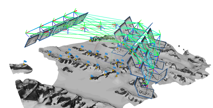
Hist-SfM
In DevelopmentAn automatic workflow for applying Structure-From-Motion on historical imagery of Antarctica using Metashape. Includes segmentation, metadata-extraction & geo-referencing.
Python
Postdoctoral Researcher
I am a Postdoctoral Researcher in the Geoscience & Remote Sensing Group at TU Delft, working with Bert Wouters and Roderik Lindenbergh.
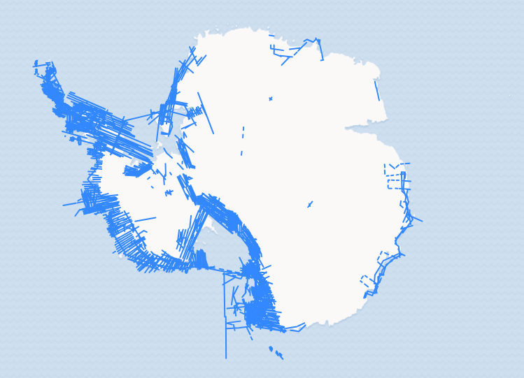
My work sits at the intersection of photogrammetry, computer vision, and machine learning — applied to one of the most demanding environments on Earth. I reconstruct historical elevation changes of Antarctic glaciers from archival aerial imagery, building pipelines that turn decades-old photographs into quantitative records of ice loss. What draws me to this work is the challenge: noisy data, extreme conditions, and few ground-truth references force creative, robust solutions.
I hold a PhD from the Geoscience & Remote Sensing Group at TU Delft, and a Master's in Geomatics, also from TU Delft. My research interests span the full stack from low-level image processing to large-scale geospatial analysis.
An automatic workflow for applying Structure-From-Motion on historical imagery of Antarctica using Metashape. Includes segmentation, metadata-extraction & geo-referencing.
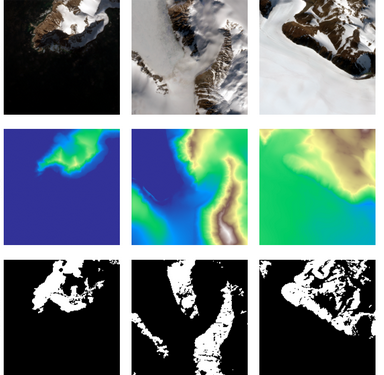
A U-Net-based deep learning pipeline for automated detection of rock outcrops in Antarctica from multi-modal satellite and topographic data.