Publications
7 publications
 2025
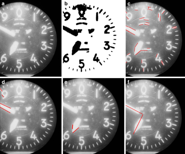
2025From Film to Data: Automating Meta-Feature Extraction in Historical Aerial Imagery
Felix Dahle, Yushan Liu, Bert Wouters, Roderik Lindenbergh
PFG - Journal of Photogrammetry, Remote Sensing and Geoinformation Science
This paper presents an open-source, automated workflow that uses computer vision and machine learning to extract essential metadata—such as fiducial marks and camera parameters—from historical aerial imagery. Evaluated on over 7,000 images of the Antarctic Peninsula, the method effectively overcomes severe scanning artifacts and missing data to enable accurate 3D reconstructions.
 2024
2024Polar perspectives: a deep dive into geo-referencing historical Antarctic photos
Felix Dahle, Bert Wouters, Roderik Lindenbergh
International Journal of Digital Earth
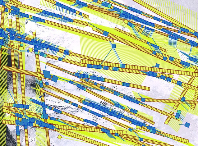
We developed a workflow to geo-reference historical aerial imagery with a use-case on the Antarctic Peninsula. Using modern algorithms for tie-point matching (LightGlue), we find similar points on historic and modern Sentinel-2 imagery for geo-referencing. A special focus is the tie-point matching, adapted to work with historical and large-format imagery.
 2024
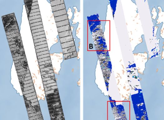
2024Revisiting the Past: A comparative study for semantic segmentation of historical images of Adelaide Island using U-nets
Felix Dahle, Bert Wouters, Roderik Lindenbergh
ISPRS Open Journal of Photogrammetry and Remote Sensing
Building on previous work, we extend the semantic segmentation of historical photographs of Antarctica using U-nets. We compare multiple hyper-parameters and augmentation methods to identify the optimal settings for segmentation of Adelaide Island.
 2022
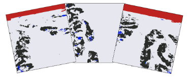
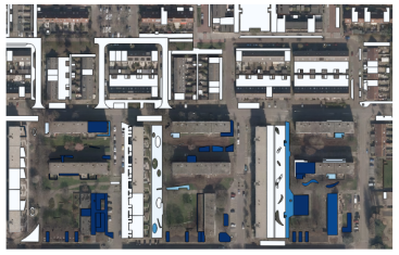
2022Semantic segmentation of historical photographs of the Antarctic Peninsula
Felix Dahle, Julian Tanke, Bert Wouters, Roderik Lindenbergh
XXIVth ISPRS Congress 2022 (Nice, France)
Semantic segmentation is applied to historical photographs of Antarctica using a U-net based machine learning approach. Results show the method handles very challenging images even when trained with only a small number of training samples, capturing the general semantic meaning of a scene.
 2021
2021Automatic change detection of digital maps using aerial images and point clouds
Felix Dahle, Ken Arroyo Ohori, Giorgio Agugiaro, Sven Briels
XXIVth ISPRS Congress 2021 (Virtual)
We show that random-forest based approaches can detect changes between two time steps using 2.5D data and transfer these insights to a digital map. Results show the methodology can recognize a substantial amount of changes and can support — and speed up — the manual updating process.
 2020
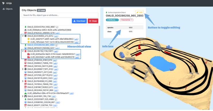
2020CITYJSON + WEB = NINJA
Stelios Vitalis, Anna Labetski, Freek Boersma, Felix Dahle, Xiaoa Li, Ken Arroyo Ohori, Hugo Ledoux, Jantien Stoter
XXIVth ISPRS Congress 2020 (Virtual)
3D city models benefit greatly from a proper web-based solution for visualisation and management. We developed ninja, a web application that allows users to easily load and investigate a CityJSON model through a web browser, providing a reference implementation for CityJSON web applications.
 2019
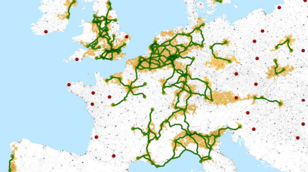
2019Europe's socio-economic disparities reflected in settlement patterns derived from satellite data
Hannes Taubenböck, Felix Dahle, Christian Geiß, Michael Wurm
JURSE 2019 (Vannes, France)
We detect urban nodes as anchor points of urban densification and identify a network of cities where conjugation lines between urban nodes feature high settlement density. These identified regions are assumed to express beneficial economic development, reflecting Europe's socio-economic disparities.