Tag
#antarctica
3 results
Publications
Polar perspectives: a deep dive into geo-referencing historical Antarctic photos
Felix Dahle, Bert Wouters, Roderik Lindenbergh(2024)
International Journal of Digital Earth
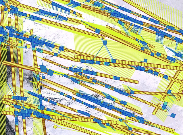
We developed a workflow to geo-reference historical aerial imagery with a use-case on the Antarctic Peninsula. Using modern algorithms for tie-point matching (LightGlue), we find similar points on historic and modern Sentinel-2 imagery for geo-referencing. A special focus is the tie-point matching, adapted to work with historical and large-format imagery.
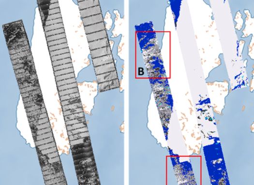
Revisiting the Past: A comparative study for semantic segmentation of historical images of Adelaide Island using U-nets
Felix Dahle, Bert Wouters, Roderik Lindenbergh(2024)
ISPRS Open Journal of Photogrammetry and Remote Sensing
Building on previous work, we extend the semantic segmentation of historical photographs of Antarctica using U-nets. We compare multiple hyper-parameters and augmentation methods to identify the optimal settings for segmentation of Adelaide Island.
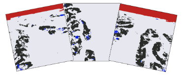
Semantic segmentation of historical photographs of the Antarctic Peninsula
Felix Dahle, Julian Tanke, Bert Wouters, Roderik Lindenbergh(2022)
XXIVth ISPRS Congress 2022 (Nice, France)
Semantic segmentation is applied to historical photographs of Antarctica using a U-net based machine learning approach. Results show the method handles very challenging images even when trained with only a small number of training samples, capturing the general semantic meaning of a scene.