Tag
#computer-vision
2 results
Publications
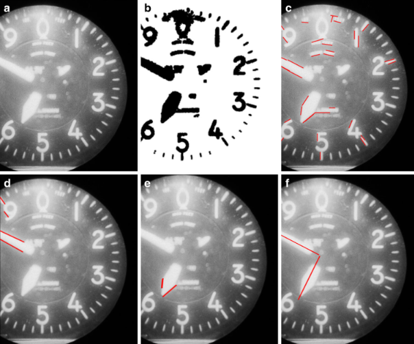
From Film to Data: Automating Meta-Feature Extraction in Historical Aerial Imagery
Felix Dahle, Yushan Liu, Bert Wouters, Roderik Lindenbergh(2025)
PFG - Journal of Photogrammetry, Remote Sensing and Geoinformation Science
This paper presents an open-source, automated workflow that uses computer vision and machine learning to extract essential metadata—such as fiducial marks and camera parameters—from historical aerial imagery. Evaluated on over 7,000 images of the Antarctic Peninsula, the method effectively overcomes severe scanning artifacts and missing data to enable accurate 3D reconstructions.
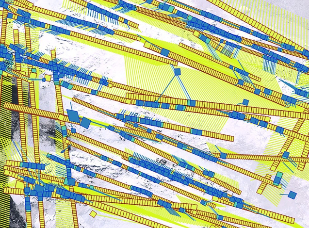
Polar perspectives: a deep dive into geo-referencing historical Antarctic photos
Felix Dahle, Bert Wouters, Roderik Lindenbergh(2024)
International Journal of Digital Earth
We developed a workflow to geo-reference historical aerial imagery with a use-case on the Antarctic Peninsula. Using modern algorithms for tie-point matching (LightGlue), we find similar points on historic and modern Sentinel-2 imagery for geo-referencing. A special focus is the tie-point matching, adapted to work with historical and large-format imagery.