Tag
#remote-sensing
2 results
Publications
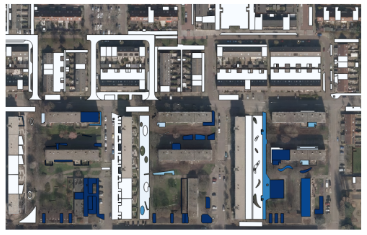
Automatic change detection of digital maps using aerial images and point clouds
Felix Dahle, Ken Arroyo Ohori, Giorgio Agugiaro, Sven Briels(2021)
XXIVth ISPRS Congress 2021 (Virtual)
We show that random-forest based approaches can detect changes between two time steps using 2.5D data and transfer these insights to a digital map. Results show the methodology can recognize a substantial amount of changes and can support — and speed up — the manual updating process.
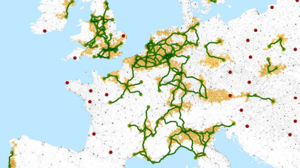
Europe's socio-economic disparities reflected in settlement patterns derived from satellite data
Hannes Taubenböck, Felix Dahle, Christian Geiß, Michael Wurm(2019)
JURSE 2019 (Vannes, France)
We detect urban nodes as anchor points of urban densification and identify a network of cities where conjugation lines between urban nodes feature high settlement density. These identified regions are assumed to express beneficial economic development, reflecting Europe's socio-economic disparities.